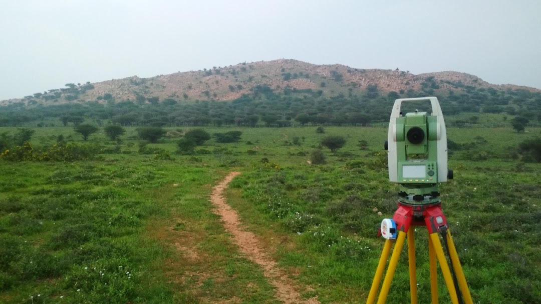
Land Surveying
At Tuwaye Group, we offer professional Land Surveying Services to assist property owners, developers, architects, and engineers in accurately defining and documenting property boundaries and land features. Our team of certified land surveyors uses advanced technology and precise methodologies to ensure accurate surveys that meet legal, regulatory, and project-specific requirements.
Our Land Surveying Services
1. Boundary Surveys
Boundary surveys are essential for defining the legal boundaries of a property, preventing disputes, and ensuring compliance with local zoning laws and regulations.
Property Line Identification: Accurately mark and document property boundaries to confirm ownership and prevent encroachment.
Boundary Disputes: Resolve conflicts between neighboring properties by providing legal evidence of boundary lines.
Title & Deed Verification: Verify property lines and boundary definitions as part of the title deed process for property transactions.
2. Topographic Surveys
Topographic surveys provide detailed maps of the natural and man-made features of a property, including elevation data, contours, vegetation, and infrastructure.
Site Mapping: Capture the physical features of a site, including slopes, trees, buildings, roads, and utilities, to aid in design and planning.
Elevation & Contour Mapping: Create accurate topographic maps that show elevation changes and contours, essential for construction, drainage, and landscaping projects.
Flood Risk Assessment: Analyze topography to evaluate flood risk and drainage patterns, important for development planning and insurance purposes.
3. Subdivision Surveys
Subdivision surveys are crucial when dividing land into smaller parcels for sale or development. Our team ensures compliance with local regulations and subdivision requirements.
Parcel Division: Survey and create accurate maps for the division of land into separate lots, ensuring compliance with zoning and land-use laws.
Legal Plats: Produce legally recognized plat maps that define the layout of subdivided parcels for record-keeping and property transactions.
Infrastructure Planning: Provide detailed information on how new subdivisions will impact existing infrastructure such as roads, utilities, and services.
4. Construction & Engineering Surveys
Accurate surveys are critical during the planning and execution phases of construction projects to ensure the proper placement of structures, utilities, and infrastructure.
Site Preparation Surveys: Provide data to assist in clearing and grading land in preparation for construction.
Construction Staking: Mark the locations of buildings, roads, utilities, and other features on-site to ensure accurate construction according to design plans.
As-Built Surveys: Conduct post-construction surveys to document the final location of buildings and infrastructure, verifying that they meet design specifications.
5. GPS & Geospatial Surveys
With the help of advanced GPS technology, we offer precise geospatial surveys for large properties or areas where traditional surveying methods may not be sufficient.
Global Positioning System (GPS) Surveys: Utilize GPS technology for high-accuracy surveys, particularly for large land areas or areas with difficult terrain.
Geospatial Data Collection: Capture and analyze geospatial data for large-scale projects, such as mapping utility networks or large agricultural properties.
6. Environmental Surveys
We conduct surveys focused on environmental factors, helping you assess the land’s suitability for development, conservation, or agricultural use.
Environmental Site Assessments: Evaluate land for contamination, environmental hazards, and compliance with environmental laws and regulations.
Wetland & Floodplain Surveys: Identify and map wetland areas or flood zones to ensure compliance with zoning and environmental regulations.
Conservation Planning: Provide land assessments for conservation efforts, including wildlife habitat mapping, waterway management, and sustainable land use planning.
7. Land Development Surveys
For land developers, our surveys provide the critical data needed to design and implement new development projects efficiently and accurately.
Land Use Analysis: Survey land to understand its suitability for development, identifying challenges and opportunities for building, utilities, and infrastructure.
Utility Location & Mapping: Locate and document existing utilities on-site to assist in new development planning, including water, sewage, and electrical networks.
Zoning & Compliance Surveys: Ensure that land use complies with local zoning laws and regulations, providing necessary documentation for permits and approvals.
Why Choose Tuwaye Group for Land Surveying?
Certified Surveyors: Our team consists of licensed and experienced land surveyors who adhere to the highest industry standards and legal requirements.
Advanced Technology: We use state-of-the-art equipment, including GPS systems and 3D mapping tools, to ensure the accuracy and precision of every survey.
Comprehensive Services: From boundary surveys and topographic mapping to construction staking and environmental assessments, we offer a wide range of services to meet all your land surveying needs.
Regulatory Compliance: We ensure all surveys are completed in compliance with local, state, and national surveying standards and regulations.
Customized Solutions: Whether you’re a property owner, developer, architect, or engineer, we offer tailored solutions to meet the unique requirements of your project.
Industries We Serve
Our land surveying services are suitable for a wide range of industries and sectors, including:
Real Estate Developers: Subdivision surveys, construction staking, and land development support.
Construction & Engineering Firms: Site preparation, as-built surveys, and utility mapping.
Agricultural & Environmental Sector: Environmental assessments, wetland mapping, and land-use evaluations.
Government & Municipalities: Infrastructure planning, floodplain mapping, and zoning compliance.
Legal & Title Firms: Boundary verification, land disputes, and property line documentation.
Get Started with Land Surveying at Tuwaye Group
For precise, reliable, and efficient land surveying services, Tuwaye Group is here to help. Whether you are buying, selling, developing, or planning any land-related project, we ensure your survey needs are met with the highest level of accuracy and professionalism.